English
  Indonesia
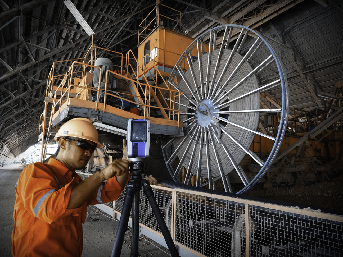
- Introducing our 3D laser scanning & 2D / 3D CAD service.
- 3D visualisation ….. the future of survey
- No more rework ….. first time fit!
- Laser scanning & 3D modelling provides a unique new survey tool
- 3 Reasons why…..
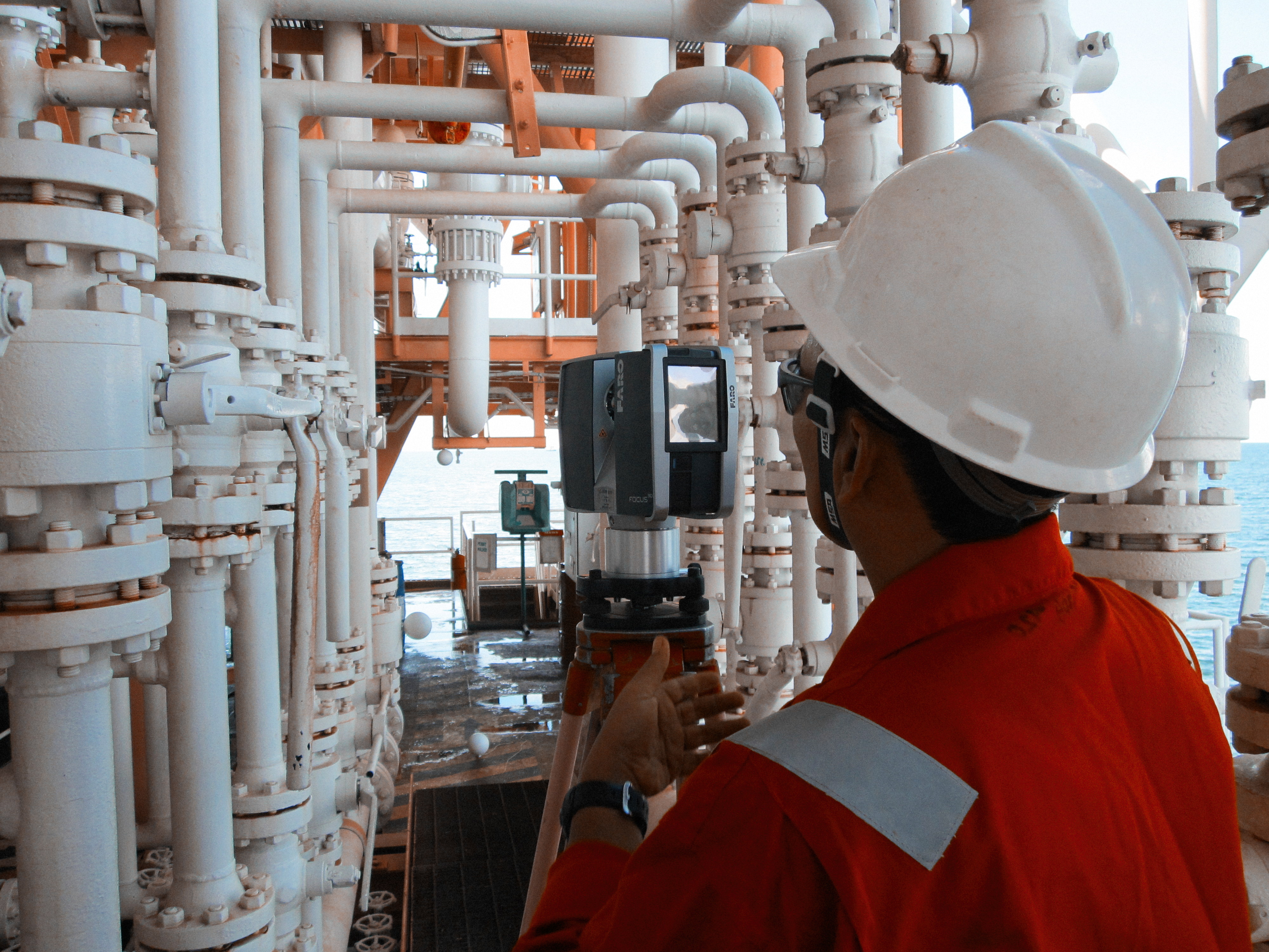
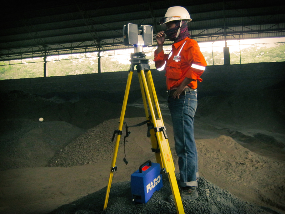
Our laser scanner uses an environmentally “safe” laser to rapidly scan surfaces or objects and record the data as a fully referenced point within a point cloud which can then be processed to enable production of either conventional 2D drawings ( “as built” plans & long sections ) or 3D image model which is highly accurate dimensionally.
These can be used for “as built” information for complex industrial plant and facilities. Other applications also include ground / topographic surveys; road, bridge & building surveys; power stations; complex models for films & theme parks; forensic science & claims records; ships & aircraft; historical & architectural records; basic information for walk through videos as well as much more.
The point cloud is immediately usable as an image that is highly accurate ( +/- 3mm ) and can be compared & merged with digital photography taken at same time.
Our clients include oil & gas companies, mining & construction companies as well as contractors involved in retrofit / maintenance for industrial plants, process facilities & oil platforms.
Our clients get a unique 3D model of their facility / plant which can be used for design, construction, fabrication and as built record that because of computer modelling will enable first time fit onsite during construction / maintenance. Large cost savings / profits can be made when carrying out retrofit & maintenance or use of prefabricated units because rework due to poor fit can now be avoided preventing expensive stoppages and production losses if things go wrong.
Our latest “state-of-the-art” laser scanner is :
• Highly portable
• Wide angle of view 360º - suitable for interior & exterior
• Range : up to 350 m
• Accuracy < 3 mm at 100 m
• Fast scanning 100,000's points in < 15 minutes
• Point cloud & photographic image available immediately
Data can also be processed to produce :
• Registered image tied to conventional survey datum
• 2D CAD drawing
• 3D CAD model
• And run clash “interference” software to check new design or that prefabricated
![]() units fit within model prior to onsite installation.
units fit within model prior to onsite installation.
• For better RETROFIT DESIGNS that slash construction costs and schedules.
• For remote and difficult access SURVEYING faster, safer and less intrusive
• For big savings and better project control during CONSTRUCTION
• For more efficient OPERATIONS and MAINTENANCE
1. Exceptionally fast Normal plant surveys take as little as :
• |
< 1 day - < 1 week field work for scan survey |
• |
< 1 week - < 1 month to process and produce “as built” views and sections of the plant with 2D CAD drawings and 3D models. |
2. Our latest state-of-the-art scanner & software technology is now available in Indonesia . |
|
• |
enables precise fabrication and avoids misfits between plant on site |
• |
enables fabrication scan check and re check fitting in computer before costly site mistakes made |
• |
first time fits on site avoids reworking |
• |
minimises construction time or downtime during RETROFIT / MAINTENANCE work and gets plant production back online faster |
• |
reduces possible tie-in clashes |
• |
reduction in rework and therefore costly contingency for this can be avoided |
• |
improve project planning and implementation using reliable as-built data. |
3. Time and Money Saving |
|
• |
Avoids use of contingency sum for poor fit and rework |
• |
reduces RETROFIT time and hence decreases loss due to production downtime |
• |
lowers plant life cycle costs |
• |
Accurate “as builts” for plant documentation and future maintenance. |