English
  Indonesia


Visualise your project with 2D maps, plans and sections...
Geoindo CAD / GIS bureau has the latest computer aided drafting technology, GIS and 3D visualisation software to enable clients to better understand & visualise their projects.
Our experienced staff can undertake a wide range of CAD work ranging from digitisation through to 2D plans and cross sections through to more complex 3D modelling and walk throughs.
Our surveyors are supported by our CAD / GIS team equipped with latest high spec. computing power and latest CAD & GIS software for
![]() Computer aided digitisation of maps & plans ( raster & rector ).
Computer aided digitisation of maps & plans ( raster & rector ).
![]() Topographic maps with contours & features.
Topographic maps with contours & features.
![]() Longitudinal sections & cross sections.
Longitudinal sections & cross sections.
![]() CAD drafting using earthworks & road design Trimble Terramodel software. Other survey software includes Geo Office, Global mapper, Arcgis, etc.
CAD drafting using earthworks & road design Trimble Terramodel software. Other survey software includes Geo Office, Global mapper, Arcgis, etc.
![]() 3D terrain modelling & photographic overlay for “virtual walk through” or “fly through”.
3D terrain modelling & photographic overlay for “virtual walk through” or “fly through”.
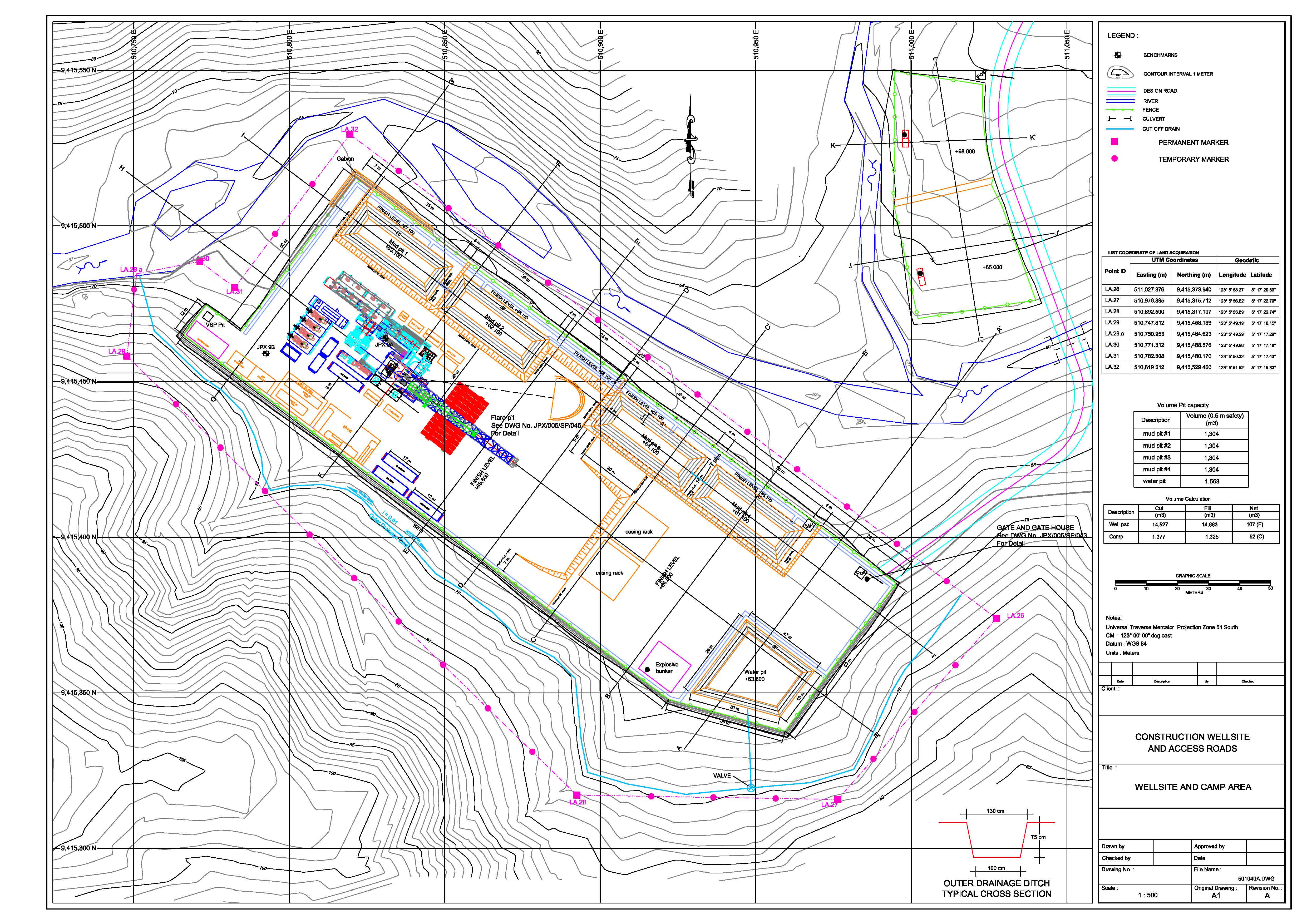
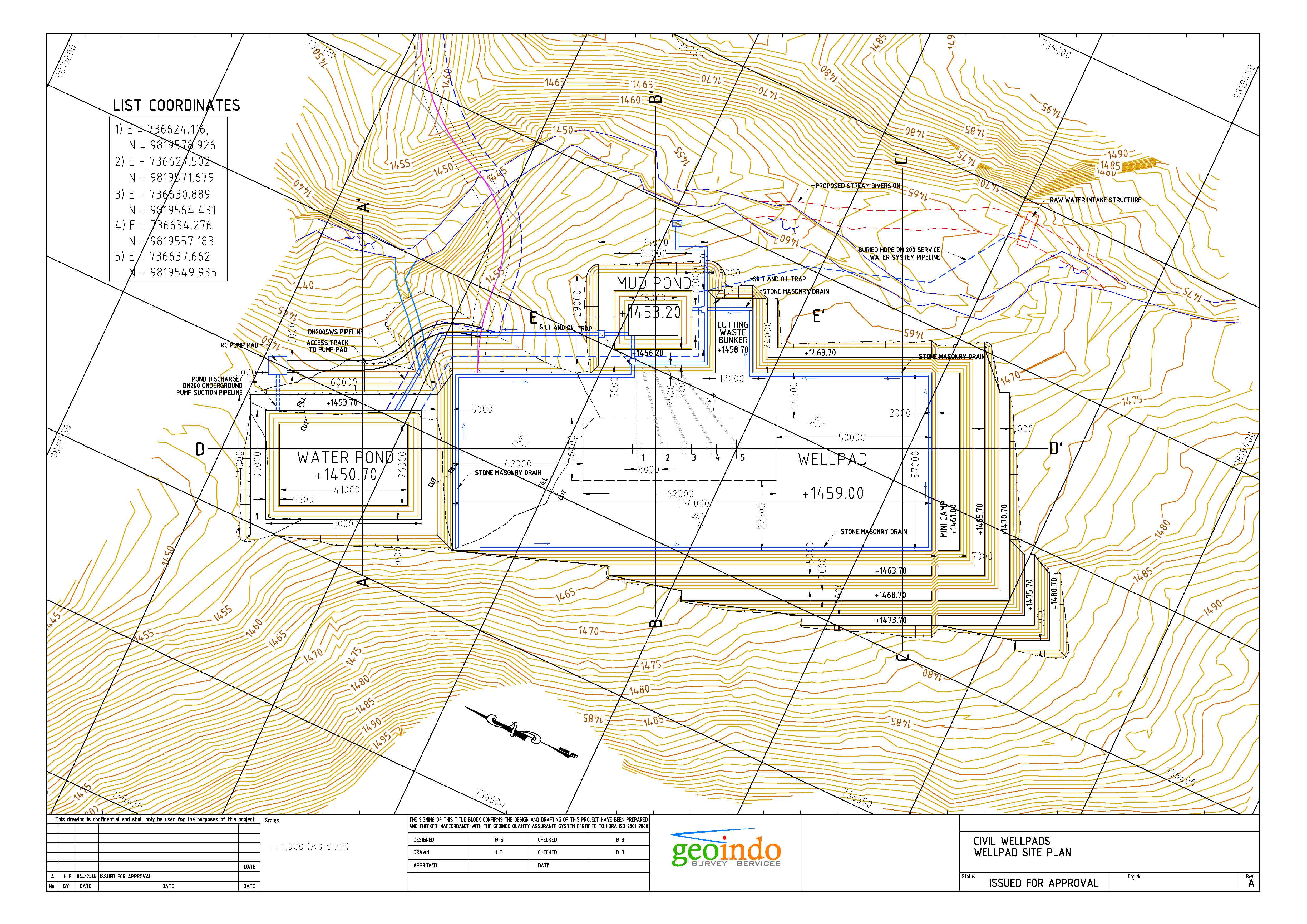
![]() Earthworks & road design. Large excavations, fills, mining development.
Earthworks & road design. Large excavations, fills, mining development.
![]() Quantities with cut / fill balancing and volume calculations.
Quantities with cut / fill balancing and volume calculations.
![]() “As built” 2D drawings or 3D models.
“As built” 2D drawings or 3D models.
![]() Production of thematic maps within a geo referenced GIS system.
Production of thematic maps within a geo referenced GIS system.
![]() Remote sensing – high resolution satellite imagery, air photography, GIS based mapping. SPOT, LANDSAT, Quickbird, IKONOS.
Remote sensing – high resolution satellite imagery, air photography, GIS based mapping. SPOT, LANDSAT, Quickbird, IKONOS.
Visualise your project in 3D...
We can provide full photographic or visual animations which enable project walk throughs or fly throughs.
Advances in hardware & software have reduced cost of modelling & made 3D visualisation commercially viable for any sized project.
Good quality, photo realistic images and animations can be used by the client for presentations, reports, planning and project visualisation that takes CAD & 3D visualisation to a new and higher level.
Everyone needs a good base map...